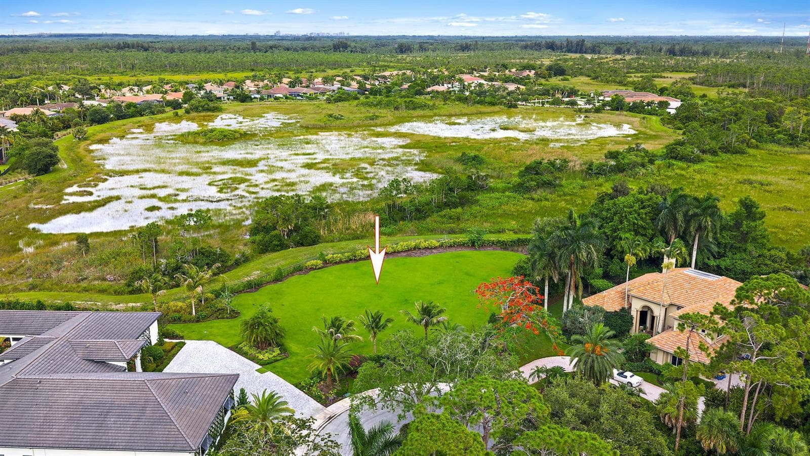
6632 Audubon Trace W, West Palm Beach, FL
About this property
Nestled within the exclusive Ibis Golf & Country Club, this rare .68-acre vacant lot presents an exceptional opportunity to create a custom estate in one of West Palm Beach's most prestigious private club communities. Ideally positioned on a quiet cul-de-sac and overlooking a serene natural preserve, the property offers a remarkable setting defined by privacy, tranquility, and natural beauty. Adding to its rare appeal, the adjacent single-family home is also available for purchase, creating a unique opportunity to own a private family compound. With exceptional space, flexibility, and an unparalleled setting, the possibilities are endless for bringing your vision to life. The Club at Ibis offers a world-class private club lifestyle across 2,000 beautifully maintained acres, blending elegance, recreation, wellness, and nature in a truly exceptional setting. Celebrated for its legendary reputation and resort-style amenities, Ibis is home to 54 holes of Nicklaus-designed championship golf, including three distinctive courses, a 20-acre state-of-the-art practice facility, premier golf instruction, 15 Har-Tru HydroGrid tennis courts, pickleball, resort-style aquatics, a luxurious spa, and a 16,000-square-foot fitness complex. Members enjoy fine and casual dining venues, a vibrant social calendar, cultural programs, clubs, workshops, and wellness-focused experiences through The CORE and the Ibis BodyMind Connection. Bordering the 12,000-acre Grassy Waters Nature Preserve and surrounded by pristine fairways, shimmering waterways, and abundant wildlife, Ibis offers a rare sense of peaceful seclusion while remaining just minutes from beaches, boating, shopping, dining, Palm Beach International Airport, I-95, and Florida's Turnpike.
Property facts
- Location
- West Palm Beach, FL 33412
- County
- Palm Beach County
- FEMA flood zone
- Zone X, minimal risk
- Ground elevation
- 17.8 ft
- Hurricane evacuation zone
- Not in a designated evacuation zone
- Distance to the coast
- 9.8 mi
Sources: FEMA National Flood Hazard Layer (panel 12099C0364F, effective 2017-10-05), USGS 3DEP, Florida Division of Emergency Management, OpenStreetMap coastline. Checked 2026-10-02. Public map data looked up at this location, not a survey or an insurance quote. Confirm with an elevation certificate, the county and your insurer.
Rent roll, cap rate, zoning, tours, off-market alternatives. Leave your email and Anthony replies, usually within 1 hour.
Interested in this property?
Contact Anthony Conners at Atlantic Commercial Advisors to schedule a showing or learn more.