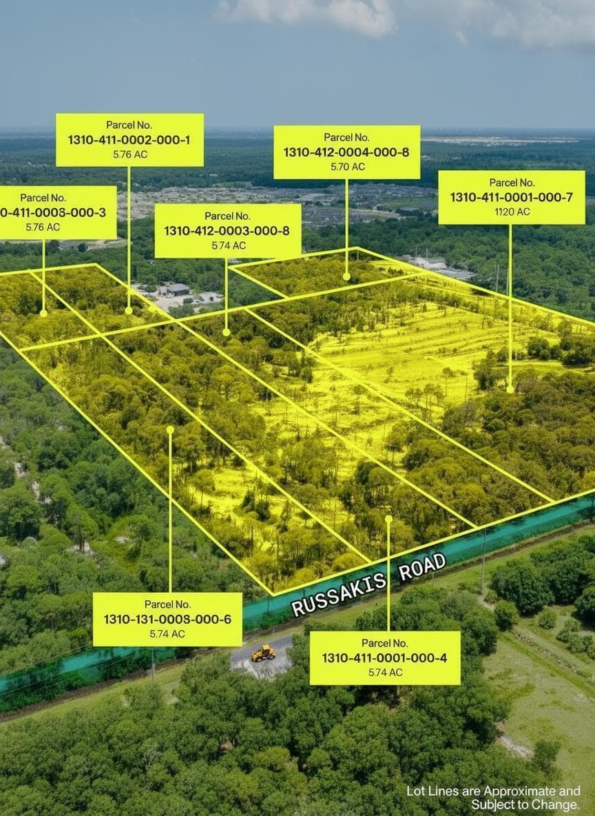
5562 Russakis Road, Fort Pierce, FL
About this property
St. Lucie County is not merely growing; it's thriving, with a projected population increase exceeding 25% in the next decade. This forecast underscores the immense demand for housing and commercial infrastructure, making this acreage a prime candidate for significant appreciation and development. Consisting of approximately 53.65 acres across 7 parcels with utilities nearby. Currently zoned AG-1, this property offers an ideal scenario for re-entitlement, paving the way for increased density and diverse development projects. The availability of utilities nearby further streamlines the development process, reducing initial overhead and accelerating project timelines. It's strategic position provides close proximity to major transportation arteries, including I-95 and US-1, alongside robust existing infrastructure within St. Lucie County. This connectivity is crucial for logistics, resident accessibility, and commercial viability. The property lies just outside of the urban services boundary and is bordered to the east by the new Waterstone Community built by one of Florida's most prominent builders, Adams Homes. Located off the highly accessible Emerson Road corridor. This is more than just land; it's an invitation to shape the future of a dynamic Florida market. Whether your strategy involves a sophisticated re-entitlement plan, a comprehensive land development project, or securing a valuable asset for long-term capital appreciation, this Ft. Pierce acreage represents a definitive investment in prosperity. Don't miss the chance to position yourself at the forefront of Florida's next growth frontier.
Property facts
- Location
- Fort Pierce, FL 34951
- County
- St Lucie County
- FEMA flood zone
- Zone X, minimal risk
- Ground elevation
- 20.4 ft
- Hurricane evacuation zone
- Not in a designated evacuation zone
- Distance to the coast
- 6.3 mi
Sources: FEMA National Flood Hazard Layer (panel 12061C0370H, effective 2012-12-04), USGS 3DEP, Florida Division of Emergency Management, OpenStreetMap coastline. Checked 2026-10-02. Public map data looked up at this location, not a survey or an insurance quote. Confirm with an elevation certificate, the county and your insurer.
Rent roll, cap rate, zoning, tours, off-market alternatives. Leave your email and Anthony replies, usually within 1 hour.
Interested in this property?
Contact Anthony Conners at Atlantic Commercial Advisors to schedule a showing or learn more.