14193 Range Line Road, Port St. Lucie, FL
Listing courtesy of The Keyes Company (John J Heaning). Contact: [email protected].
About this property
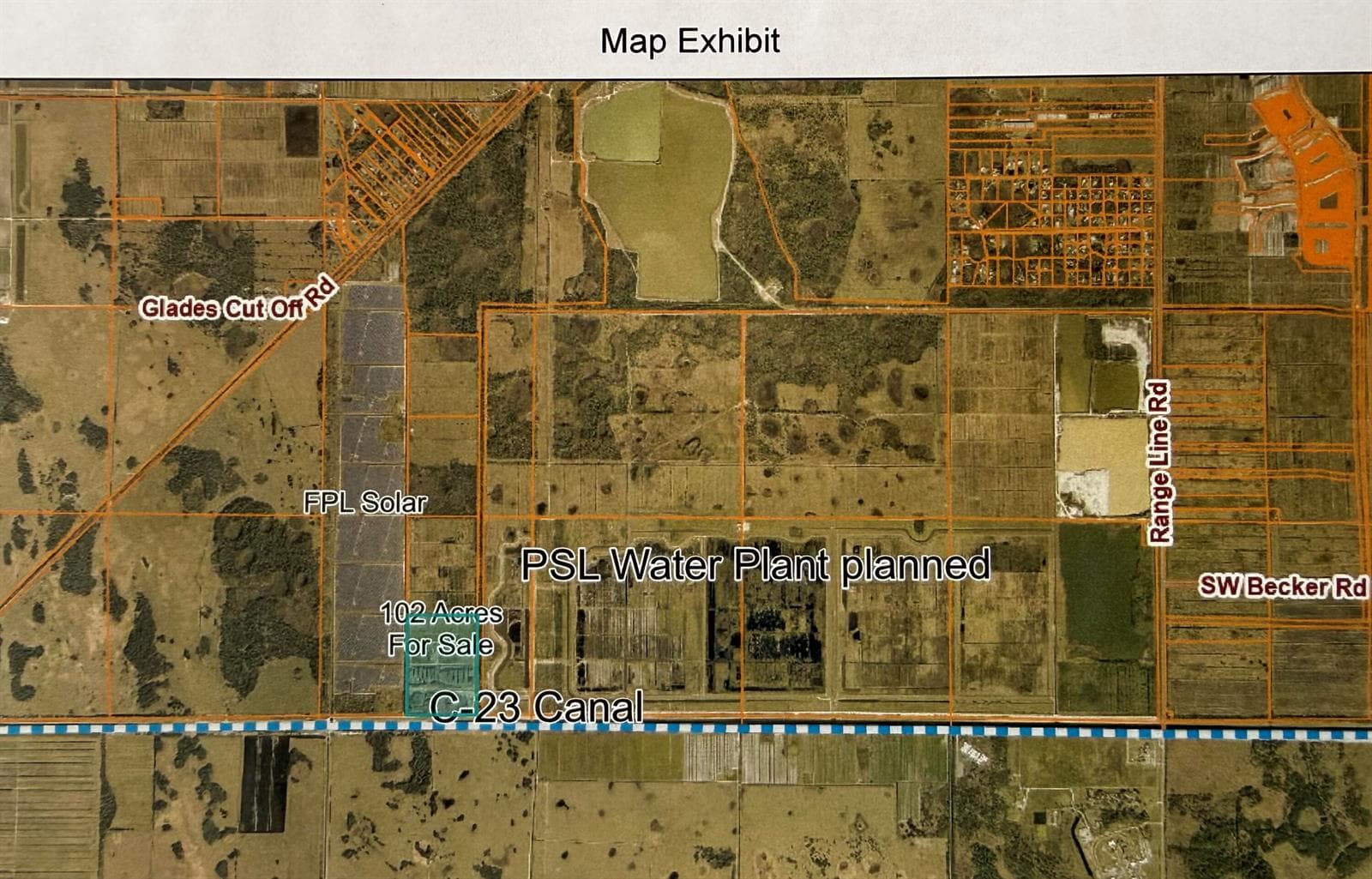
102.42 acres of AG-5 zoned land for sale at $45,000 per acre in Port St. Lucie / St. Lucie County—an exceptional opportunity in an area that is rapidly becoming prime due to ongoing growth and corridor development. This tract is currently being used by Mike's Organic Topsoil, providing premium compost and natural mulch, along with fill and topsoil. That means the land is not only an investment for future demand but also producing value today and is well-suited for buyers looking for continued use or the opportunity to reposition for major uses down the road. Location & Surroundings: The property is located along the C-23 canal to the south, with Martin County to the south of the canal. FP&L is to the west, the Port St. Lucie future Water Plant is to the east, and AG-zoned land north. The property is accessible from Range Line Road, and it is conveniently located close to I-95 with easy reach to Martin and Okeechobee Counties. an 800 ft Artesian well flowing out of the ground. The property benefits from strong regional momentum, including projected population increase, fastest-growing corridor activity, and continued city expansion west. The County also has future land needs tied to planning and development. In addition, FP&L is seeking land for solar fields, which adds timely investment potential and long-term demand for large acreage tracts like this. A quality AG-5 tract with current productive use and strong future upside—ideal for investors, land bankers, agricultural users, or energy/solar-related buyers. Buyer to verify permitted uses, zoning requirements, and all development constraints.
Property facts
- Location
- Port St. Lucie, FL 34987
- County
- St Lucie County
- FEMA flood zone
- Zone X, minimal risk
- Ground elevation
- 24.9 ft
- Hurricane evacuation zone
- Not in a designated evacuation zone
- Distance to the coast
- 18.3 mi
Sources: FEMA National Flood Hazard Layer (panel 12085C0100G, effective 2015-03-16), USGS 3DEP, Florida Division of Emergency Management, OpenStreetMap coastline. Checked 2026-10-02. Public map data looked up at this location, not a survey or an insurance quote. Confirm with an elevation certificate, the county and your insurer.
Rent roll, cap rate, zoning, tours, off-market alternatives. Leave your email and Anthony replies, usually within 1 hour.
Interested in this property?
Contact Anthony Conners at Atlantic Commercial Advisors to schedule a showing or learn more.
Listing data courtesy of Miami REALTORS® / Southeast Florida MLS. This site is operated by Anthony Conners, Atlantic Commercial Advisors, KW Commercial. Atlantic Commercial Advisors is not the listing broker unless stated.
Listing data last updated Oct 5, 2026, 11:54 AM ET.
Listing data provided by the Southeast Florida Multiple Listing Service (MIAMI REALTORS®). The data is deemed reliable but is not guaranteed accurate by the MLS.
IDX information is provided exclusively for consumers' personal, non-commercial use, may not be used for any purpose other than to identify prospective properties consumers may be interested in purchasing, and is deemed reliable but is not guaranteed accurate by the MLS.